Ask ChatGPT
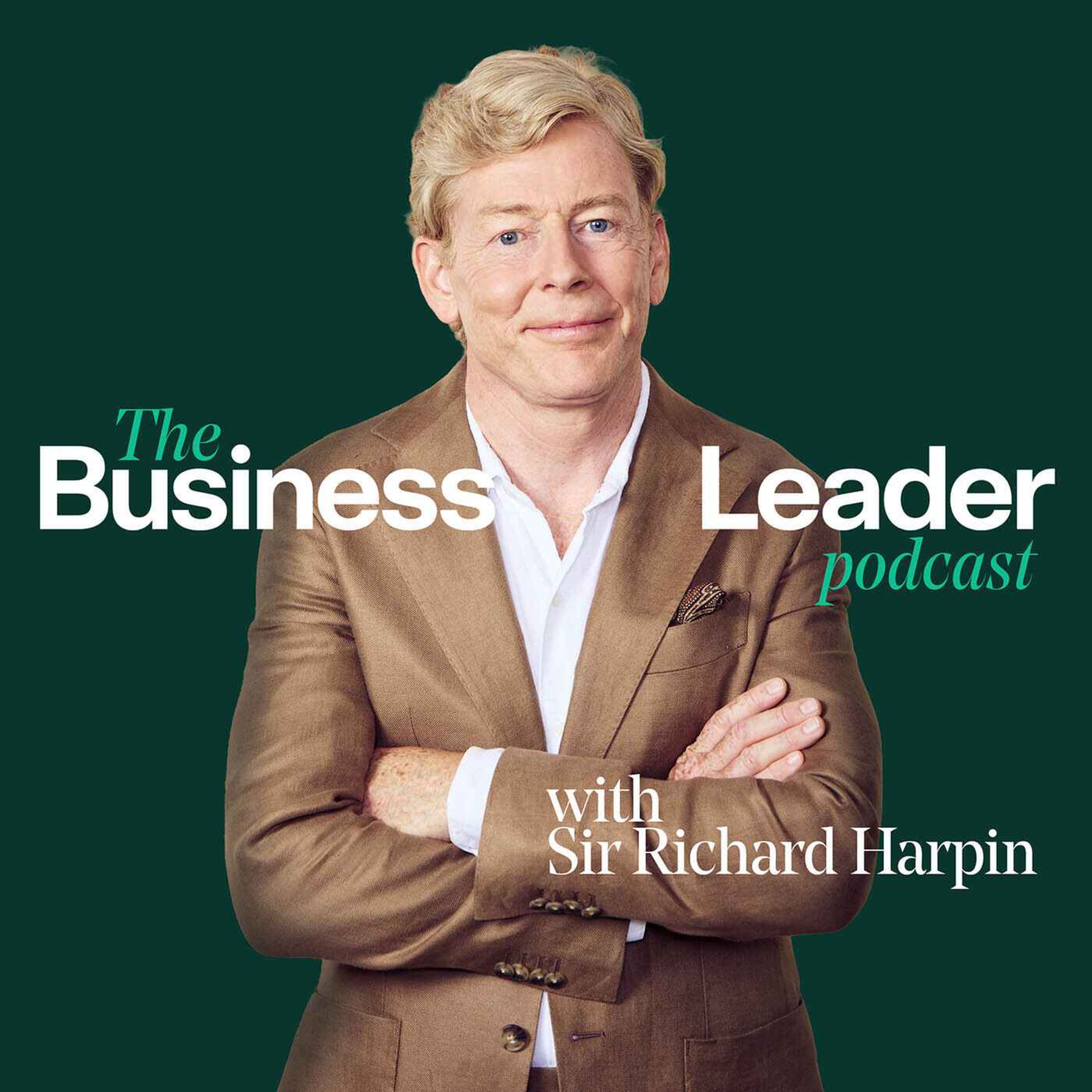
 The Business Leader Podcast with Sir Richard Harpin
29 Apr 2025 · 34m

Host: Richard Harpin
Nick Bolton, CEO of Ordnance Survey
In this episode, Dougal Shaw interviews Nick Bolton, the CEO of Ordnance Survey, a historic British institution responsible for mapping the United Kingdom. Founded in the 18th century to protect against Napoleon's invasion, the organization has evolved to become a leader in digital mapping and data management, now leveraging technology such as artificial intelligence (AI) and a significant digital database known as the National Geographic Database.
Written by AI. May contain mistakes.

Get the gist, explore an idea or ask about something said.
 Claude
On The Business Leader Podcast with Sir Richard Harpin, what are the key points of this episode?
Searching your listeningAutomatic transcript. May contain errors.
0:00This is Britain's growth moment. Do you want to be part of it? On 26th of March, 750 of the UK's most ambitious founders, CEOs and investors will gather in London to shape the future of mid-sized business. The company's driving our nation's success. The Business Leader Summit 2026 isn't just another conference. It's a day built around the three forces that define growth, ambition, policy and capital. And as one of our valued podcast listeners, you can be there in person. To secure a discounted ticket, visit the events section of our business leader website and use this code. BL podcast, all one word, all uppercase.
0:41We look forward to seeing you there. So who sits over there, for example? So here we've got sales and our customer service center. A bit further down here, we've got products. So the guy sucking into his sandwich at his desk, that's our head of product. We've got people and consumer at that end. And then over here, we've got corporate services, legal finance. And then in here, in the data room, that's where we keep the National Geographic database. That's the half a billion features all sitting there waiting for people to access them. That's Nick Bolton, CEO of the Ordnance Survey, the official mapping service for Great Britain.
1:15He's giving me a tour of his HQ in Southampton, including its big digital brain, the National Geographic database. So in there is like a massive room of hardware and that's where the knowledge rests. Yeah, well, it's where it resides. I mean, clearly there's an army of folks that are creating that thing, keeping it up to date, making sure that's an enduring capability for the country. But right now, it's all in there. And also, it doesn't just reside there. We do have reasonable cloud recovery and so forth. So we do know what we do when it comes to data. One of the great things when I first came in, I was allowed to go out with a surveyor and survey.
1:49So my kids live just outside Reading. My kids have grown up in Reading. And so I surveyed a playground. That's the level of granularity. You know, it's that level of data position attribution characteristic that's all sitting behind that door. I'm Dougal Shaw and this is the Business Leader podcast. In this episode, we are going to inspect a great British institution, the Ordnance Survey. The mapping service started in the late 18th century and more than 230 years later is still going strong. Nick Bolton joined as CEO in October of 2023. His background is in private sector tech companies, including leading Oxford Metrics, which developed the avatar technology used in the ABBA Voyage Show.
2:35Ordnance Survey is owned by the government, but operates like a business. It recently reported annual revenues of more than£180 million. It is perhaps best known for its colourful paper maps used by hikers. The same information is now available in digital form in its app, used by 6 million people. But the Ordnance Survey makes most of its money by helping businesses to use the unique digital data set it possesses. This data is collected in a pretty extraordinary way. So we have a flight crew that flies the UK once every three years. So they effectively tracked her up and down all of the imagery.
3:12That's the sort of imagery that you might see. You know on Google Maps or Apple Maps, they show you satellite imagery. It's not satellite, yeah? It's actually aerial. It's captured from a plane. In this episode, we'll hear how companies use the Ordnance Survey's data, we'll learn how Nick Bolton has found the working culture in this government-owned organisation, coming from a private sector background, and he'll also explain how the Ordnance Survey has been an early adopter of artificial intelligence. But first, he explained to me a bit more about the origins of the organisation.
3:47Founded in 1791 in order to protect these shores from Napoleonic invasion. So while British navies were abroad, the concern was, well, if we, Napoleon might decide to hop across the channel and invade. And so we better know really how the south coast is shaped up in order that we can particularly fortify Britain. That was 1791. You could argue we're one of the oldest tech companies in the UK because technology has been at the heart of that during that whole time. And really for the first 200 years, what we did was pretty much the same. You know, we surveyed, we plotted, we refined and we printed maps.
4:24And we did about half a billion maps over that time, both for military purposes as well as for civilian purpose. And then really over the past 25 years, that's all very dramatically changed. So we don't have a print press here anymore. We now produce digital geospatial data sets. We still do print maps, and so you can go for a walk on a Sunday afternoon and find a really good pub through some nice hills using our paper maps. But over that last 25-year period, the world's gone digital, and so have we. So now the way we survey it, the way we refine it, the way we then serve that data actually is now a completely digital pipeline.
5:01It means that our data now ends up in a wide variety of sources depending on the applications, be that for blue light services making sure the ambulance tips up at the right address to make sure they can save a life all the way through to how we better plan when the next housing estate should be or shouldn't be or what infrastructure do we need for that so what's lovely about ordnance survey is that today actually sits as the almost this invisible fabric that underpins all sorts of aspects of public life and that's really fundamentally to do with everything happens somewhere you know we can look out the windows uh here and you know there are people who've got to maintain that grass and look after that road and make sure the road does stay connected and that the nursery does have a car park all of that is happening somewhere and so if we want to better plan for that and better manage that you know what you need a digital representation of it ordinance survey does that for the country and an interesting thing about the os is that you are owned by the government but you operate as a business but you also i think have shareholders so tell me a bit about how the structure works and how that affects you leading it yeah so we're a govco and this is my first ever role as a public servant previously i've always been in the private sector i've run public companies i've run startups and i've worked in other private industry we're a govco so that means we have one shareholder and that one shareholder is the government and for us it's the department of science innovation and technology and so they're ultimately responsible for us and if the shareholder as with all the businesses if the shareholder was disgruntled with what you're doing you soon hear about it and you better adapt to the plan that they want to undertake.
6:32But otherwise, we operate really as an independent business. And then it really comes about, well, how can we better deliver value for the country, private sector, public sector, you know, across the board, the consumer, as well as business, as well as government? How can we better build, better support Britain in its task? And that really does range across a very wide range of sectors, as I mentioned at the top. And you talked about the digital transformation. So by the time you arrived as CEO, had the company started to evolve to allow that to happen? Or are you still changing the structures in terms of hiring strategy to make it a fully-fledged tech company?
7:08So that was all well in train, right? So as I say, I've come from a leading technology businesses. That's my background. I've been CEO of tech businesses for the past nigh on 20 years, right? And so I'm really just a continuance in that transformation. But are there more things yet to do? Well, of course there are. I mean, I do think we are a beacon inside government for how to do large scale data production, data management, which, you know, if you think about the challenges that are facing the country now and the new missions that the government have brought in, underpinning all of those is data and is technology anyway, be that energy, be that economy, be that health or any of the others.
7:49right and so ordnance survey has very much a role of both being able to be a center of excellence and understanding about how you actually deliver digital uh dividends digital benefits for for the country as well as actually being the provider of the geospatial data because all of those things like economy like health like crime like making sure there's opportunities for everyone that all that all happens somewhere so our data and how it's actually used needs to be a release or a value And the build on that is to say, yes, we produce the data. One of the things we talk about internally is producing the data isn't enough.
8:23So data in itself has no intrinsic value. It only has value in its extrinsic expression. So if you're a football fan, but you're a very strong Birmingham City supporter, if I told you about the results of Burnley or, worse still, Aston Villa, or how many passes Villa managed to complete in their European game, it's irrelevant to you. What you really care is about what was the result at St Andrew's the weekend. In other words, there's no value to the data until it's actually meaningful and used inside end application. And so that means we as the national geospatial data provider, yes, we have to do that incredible job producing that data.
9:02But also we have a responsibility to make sure that our end customers, be that business, government or consumer, actually have a way of roping that in and answering the geospatial questions that they've got. Asking a geospatial question is very straightforward. answering it is much more complicated you know if you and i were to decide ask the question where should we meet on saturday to walk the dog and then have half a pint of beer uh at the end that's that's quite readily uh asked well to to answer that we're going to pull out a map and we're going and that's quite a straightforward question when you then think about things like where should i put uh an ambulance uh or a paramedic where millwall come to place southampton away on which corner well then that's relatively straightforward to ask and it's important question to ask because it might save someone's life or stop a massive Q &A and E.
9:46But actually it involves a whole bunch of different data. It involves data from health, it involves policing data, it involves geospatial data, and then we've got to rope all that in and then say actually what needs to be on that corner or rather than that other corner. That's the bit of value we're trying to unlock for the country is how to make the answer to those geospatial questions straightforward.
10:08You know, the consumer side of the business for you makes up less than 5 % of revenues, So that's things like OS Maps for accessing it on your mobile or the paper maps, even though that's kind of really dwindling now. But how important is that for you? And I was thinking, you know, I came here, I use Google Maps to find you. The taxi driver had built into his car its own kind of, you know, map service. Do you see Google and other people like that as rivals or are they in a completely different domain to you? They all exist in the same ecosystem. them um back to your point about paper map we're still fiercely proud of paper maps yeah and there still is something that's incredibly emotionally connecting about paper maps people don't put spreadsheets on their wall right they put maps on their their wall and we shouldn't forget that there always will be a place for a paper map um but equally with that needs to set alongside the very modern os that is also driven these geospatial uh data sets when it comes then to if you think about where how the world was in you know the end of the 80s and the early 90s you know ever since then we've seen a mass explosion of maps i mean each time you search for a route in google maps or apple maps or in that sat nav in the taxi driver's car you're creating a new map in that instance right you know it's a that means that millions and billions of maps are now being created every single day some of them are very specialist purpose which is kind of where we tend to get involved the ambulance dispatching uh the where should i dig up the road where can i put a housing estate and so forth so there's always will be a place for those things but at the same time there's a consumer application there you know the great thing about google maps is it's a point of interest database but presented through a visual interface actually quite straightforward mapping application what's very impressive about it is the scale of the thing and in those environments you still need great geospatial data yeah what google's real strength has been to aggregate all that data so it works in Kuala Lumpur as well as it works in Kenilworth right so we have a role to play there but of course our domain is Great Britain yeah that's the bit that we know better than anybody else so of course we'll have a role to play there surfacing our data in all of those consumer apps and it's not just the ones that you use when you're walking around cities it's also the ones when you get on your bike and you're riding around the country or when you're going for walks and actually OS Maps is an incredibly successful product you know it's a digital app that now i think is only second to strava in the uk is the most used outdoor application that's that's a tremendous british achievement and again that then actually we you know ordinance surveyors respected the world over yeah so when i go to these various international national mapping agency uh conferences uh the the rest of the world looks to us they see us as the model both in terms of our structure in terms of the our modernity in around uh data management and And actually then also having this focus on how do you actually get geospatial data to unlock real value for the country.
13:03That's something we should be really fiercely proud of as a country. And it's something that I think we can continue to lead the world in. If we do that right, then the Googles and the Apples and the other folks inside that incubated ecosystem will only get to benefit. And that, of course, will be a benefit to us then as citizens. and talking about unlocking value so you have the geovation hub which i've visited before that's primarily helping startups and giving them access to your data sets but on business leader we're you know very interested in the medium-sized businesses in the uk in what kind of ways can you help them so that's the world i know really well because that's where i've just uh come from running you know a small to medium-sized plc uh in that environment where we did actually use ordnance survey capability and ordnance survey data we're providing a solution to local authorities and so the great thing about being a customer of an organization you then become the CEO is you can actually bring some of the frustrations as well as the great things that you used to celebrate to actually bear inside the organization to hopefully then deliver more for more customers and more readily so the role before I was a CEO of Oxymetrix PLC we had a series of startups but the one specifically you know ordnance survey mapping was inside Yotta which was a connected asset management software business.
14:18We used to provide our software to local authorities and international agencies to manage the assets that really related to highways. So I think the quote was at the time, half of the UK's lighting, street lighting, so that's bollards as well as street light illumination, was inside our software. So, you know, a very real application, but very focused in and around roads. um so in in that world anybody who's got either a need for geospatial expertise or geospatial uh data and because everything happens somewhere pretty much that's true for logistics business as it is for um a uh as a highways business or a agriculture business you know it touches almost all markets actually which comes to a different business challenge you know in lots of ways in business what you're trying to do is identify a specific audience that you want to delight in a certain way you've got a specific problem um and you want to be able to address that problem for them in a repeatable uh manner that's kind of what business is which is why you've got to be i'm a great believer in being very precise about who it is you're targeting what your remedy to them is and and build from there yeah there's peter teal's written this book from uh from zero to one have you yeah it's it's it's it's uh it's great and one of the things he talked about there he's never interested in somebody says well i'm gonna i'm gonna build a one percent share of a hundred billion pound uh marketplace he's much more interested in somebody's gonna build a hundred percent market share of a business worth two million and then from there from that monopolistic position build a little bit bigger a little bit bigger a little bit bigger and i think that's that's really true and again there's i think there's an important piece of advice in there for medium-sized businesses which is all about making sure you're a specific thing to a specific audience one of the challenges we have is that well we're used in a wide variety of One of the first projects I kicked off when I came in was a segmentation project.
16:08When we think about our custom base, how do we divide those up? Well, that project has led to us having 13 sectors made up of about 60-odd different segments. That's enormous. How do you then go about building a business model to actually – and the answer there is embrace the ecosystem. In other words, there are other people who've got even greater sets of expertise within those segments who can actually adapt our data set or our capability in that marketplace. And so that might be someone who's got expertise in financial services and say, well, actually, I do need your data because I want the unique property reference, which is something that we can provide, which is then on a map, which says for this address, 21 Acacia Avenue, we know that this property has got that unique address.
16:50We know what that building is, what its footprint is, its area, how tall it is, what its energy characteristics are, what the angle of its roof is. Because actually, if we're going to lend on that property or we're going to have a flood risk, we want to be able to know how that property relates to floodplain. That is all something that we have the geospatial data provider. Now, that's of interest in that world. Flooding for a farmer is a very different thing. So even in that world, this is probably the same data set being interpreted in a different way. So the way that we adapt then for that wide variety of different user groups, customer groups, is actually co-opting the ecosystem to join our gang.
17:27And actually, that's the way then to build a better Britain through geospatial understanding, co-opting someone else's army to your cause. If they want to join you, what are the different kinds of models? Because I've seen things, you know, like people called licensing partners is one, other times premium users. So is it always kind of pay to play with you or how does it work? Well, so there are some data sets we provide which are under the open government license. So those are effectively open free data sets. And they allow people to get started. For where the data sets are premium, in other words, they cost us more to collect them.
18:04But, of course, they actually provide greater value then to the end customers. Those are paid for items. So really in all of that, we have slightly different licensing models depending on the specific nature of the products that we sell. But again, that happens in all of those markets. I mean, I would say if any of your listeners are listening to this and they've got geospatial problems and they think that we might be able to help in that, get in touch, right? And if we can get in touch, I'm sure there's a way that we can work out how, whether it's we do that directly, whether we introduce them to partners who've got the expertise there.
18:37But let's make sure we have the conversation. Now, we're the National Mapping Agency. We're funded by the government because otherwise certain things just wouldn't happen. There needs to be necessary government intervention. Otherwise, London would be really well mapped, but you might find other bits of the country that aren't because there's more commercial advantage in a high density of population and services that are around that. But equally, you know, 70 odd million of our revenues comes from the private sector. So there is commercial opportunity. If somebody is getting commercial benefit from our products, then, of course, we should be sharing in some of that wealth.
19:09So across the board there, whether it's government agency, private business or consumer, we want to lift the use of geospatial capability to the country. It's something we do really well in the UK. And there's a great big unlock there for all of those groups in building a better geospatial Britain. And I suppose in that sense, I mean, one of your roles is to help the government achieve its targets. One of those targets is economic growth. Is that what you're trying to do through your data? One of them, yeah. Yeah, and I think if you talk to folks in Whitehall, all five missions are important, but if there's one of them that's perhaps the mission above all, it's the economic mission, which kind of makes sense, right?
19:46Because if the economy is growing, that gives us all choices as a society, how we then deploy the dividends from that in health, in energy transition, in crime management and so forth. So yes, it's very important, but that's not to belittle any others within there. They're all equally important. And actually, the fact that we now have a Department of Science Innovation Technology, that's a great place for us to be because you know it's technology insight science that it does provide that horizontal layer that should deliver benefits all sorts of walks of life and geospatial capability geospatial data is exactly one of those yeah we have to then make sure that we best support the government government in doing that if you think then about our experience in providing in capturing providing managing that enduring data capability there's an awful lot of interest investing government now so they've now want d-sit to be the uh the center of digital government the digital center of government and we think we've got a lot to give in there just from a you know the core point about our own technical expertise we've been doing it for a long time we haven't been doing it without mistakes sure there'll be mistakes in them but those are mistakes that we should have made so that the other the rest of the community can then learn from initiatives like the national data library which i don't know if you've you've heard of but that that really is a is a wonderful opportunity to to make sure that the value of that data it can then release value for the citizen give the citizen their time back you know that's as simple as some of the examples that happened already today where if you have your passport photo taken you can now use a passport photo for your driving license application simple things like that things that we would just expect to work in the private realm should just be as readily achievable in the public realm i'm a big believer i wouldn't have taken this job if i didn't think that there's a big unlock for the country in in achieving exactly that.
21:34While I was exploring the building with Nick Bolton, we had an interesting chance encounter, which you can listen in on here. Greg here, how many years have you been in? 44 years, Nick. 44 years, and everyone's a pleasure? Every year's a pleasure. And even more now, you're here. Oh, there you are. Are you aiming to make the half century? I want to get to 45, definitely. What, is there a holiday reward or something? No, it's just nostalgia. Nostalgia, it's just nostalgia. Yeah, but 50 would be bigger than it. The longest serving current member we've got is 54 years. Amazing. That's a great organisation.
22:07In fact, after my appointment with Nick Bolton, his next meeting was with an employee who was having an official chat to celebrate a significantly long work anniversary at the Ordnance Survey. Non-commercial organisations, including the civil service for example, often attract employees who stay at the organisation for a long time. They are deeply passionate about what they do, which is also why they might not be tempted away by typically higher wages in the commercial sector. The idea of job security and often a good pension might also appeal. I wondered how this affected the company culture.
22:39You come from the commercial world, come from the tech world as well, into, you kind of in a way stepped into a more like civil service environment. And what the civil service has actually said recently from the top is that we want to be more entrepreneurial. So what's your perspective on it? Have you seen a few things where you go, oh, I'm surprised they do it this way? The overriding comment I would make, and I can really only talk about Ordnance Survey, because that's where I spend my time. And the great thing about Ordnance Survey is the people here, there's something that connects them outside the building.
23:13So before they walk in here, we're already culturally connected. Genuinely, the people here are smart, bright, some of the brightest people I've ever worked with, and they're nice. and it's amazing that working in an environment where actually people are nice and wanting to achieve a collective purpose that's the point that they there's something connects them outside the room so when they come into it there's no doubt about what the collective purpose is we we know it's that how do we get that stuff uh done that's in that was in some ways that was that's hardening yeah i think it's too easy to look at uh civil service and somehow see them as a drag on society i don't see that at all um certainly not now being within this this uh great organization i can't comment about other services i can very much talk about this one because there's that motivation for public service and it's it's it's it's that that that idea of sort of public duty but bringing every single sharp edge of innovation entrepreneurship to bear because we don't have a choice there because the world as you you know as you pointed out earlier on in this conversation that the world is moving super fast in geospatial understanding full stop things like google things like apple and global mapping initiatives the use of earth observation satellite imagery to really create very quick maps for areas that are changing that you can get now to have changed every 20 minutes and you know low earth orbiting satellites aren't getting any less anytime soon so that all of those great opportunities will means that we will stay sharp on all of those things but with that core purpose about how do we deliver value for the country so AI artificial intelligence is obviously the thing that a lot of business leaders are thinking about how can I use it to improve my business it must be useful in the in the data driven world of maps sure absolutely so uh the big breakthrough so the background to the business I was running was is all in computer vision so I've been in computer vision since uh 95 yeah um and the big breakthrough in machine learning was the application of convolutional neural nets to vision problems in 2012 right so although the world's woken up to large language models and transformer networks are super impressive you know that's all happened sort of two years ago the vision world has been in this world since 2012 and so has ordnance survey so we don't just talk about and it's not just running as a research project the way that we extract a lot of the features within from the aerial imagery that we capture is all done using machine learning and that happens today that's not science that's not what are we going to plan for it and and so actually again i think we can help both businesses as well as government learn the practicalities of how you bring that to bear and there are some practicalities to do that because the challenge you've always got the machine learning system is it's got a non-deterministic output right so the great thing about a traditional algorithm is that you can determine what the output's going to be for a set of inputs addition one plus two equals three two plus one equals three symmetry but the uh each time we put a one and a two in there we're always going to end up with three the challenge you have machine learning systems is that you're asking the computer to take this wide body of data and for it to assimilate the associations between that data and so the challenge with that is that you might add a put a one and a two in that system and more often than not it comes out with a three and every now and then it comes out with a 51 million 365 205 yeah and that the problem with that is that you then have got to make sure your process for that has a way of catching that now you know the the transformer networks talk about hallucinations i don't know that's a very helpful term this is this is all really just the consequence that a machine learning system you've asked the computer to spot the patterns rather than the mathematician to spot the patterns.
26:57So that then means you need a different process around it. We've been doing that for 12, 14 years now, yeah. Did you develop your own AI models in here, or were you getting them off the shelf from someone else? So we developed them internally, because one of the things we have is a surface of data. I mean, there's two things you probably need for machine learning. One is decent training data sets, yeah, of different varieties, sometimes, you know, highly labelled, sometimes not labelled for unsupervised learning. And the second thing you need is a decent design of a net or a set of algorithms, if you like, to then manage those things.
27:34Well, we got the first one in buckets and spades. We got a whole bunch of really clever people who were drawn to this organisation because they saw the data sets and they were interested in that task. And so, you know, on both those fronts, we own that. Now, that doesn't mean we don't then test it with external models. We're doing that all the time. But equally, what we've found is that actually what we own internally is performant and is doing what we need to do. And that gives us the flexibility for the future. And a hallucination, if we want to call it that, that could happen would be something like, I don't know, the map generates a public house in the North Sea or something like that.
28:07There's little moments like that. Think about it more as, right, we've got a big image tile that we've taken from a drone image or from a low-flown aerial image. And we've asked it to extract hedgerows. yeah and we want to know the line of the hedgerow and we want to know the type of hedgerow you know is it blackthorn is it deciduous or is it evergreen etc that level of detail you do oh yeah yeah well because i mean that that's another thing to remember about maps is that we we sort of think about it as it might be a bridleway or a footpath and a bit of road uh but actually now the maps that are being produced are down to that level of granularity so if you think about every local authority knows where every drain cover is because they're the water company also knows where they are and they know where every lighting column is they know how much power they draw they know what bulbs in it and they need to know all that stuff because there's some person who's got to maintain it right and actually electricity itself is unmetered yeah uh from local authority so they have to keep a log of that because that's actually how they pay their electricity bill it's drawing this much power on this day and so forth so that i mean you come to an important point there is that it's easy to look at one of the survey and think well actually how deep does the data go well it's there's 500 million features in our national geospatial geographical database that's today half half a billion features just sitting there waiting for you to ask a question of it that's very different even than the wonderful pink and orange maps and the amount of data it's it's it's gone up you know inordinate orders of magnitude at that level so coming back to the point about machine learning we take that tile we've asked it the question instead of it saying it's deciduous it's lo and behold it's found it's evergreen that's a that's an error at that level yeah um so that's why you've got to make sure then you've got a different qa process around the other side to make sure that you check at that level so in in military they'd call that person in the loop or man in the loop yeah and so you've got to make sure you do that now there are ways to do that and automate that which might be through sample checking or it might be having a different algorithm that's checking the other algorithm etc all of that stuff is actually the engineering task yeah that you've got to make sure you get roped in uh ml for it's actually delivered for your business does that information with that kind of detail is that coming from satellites or drones a mixture of drones and low-flown aerial so we have a flight crew that flies the uk once every three years so they they've actually tracked her up and down all of the imagery that's sort of imagery that you might see you know on uh google maps or apple maps they have they show you satellite imagery it's not satellite yeah it's actually aerial it's it's captured from a from a plane yeah um satellite imagery itself is getting there right so increasingly they're putting better sensors on board uh the satellites that gives you a better resolution on the ground we're not quite there for how that compares to what you can capture from drone or low phone and the answer will always be and this is probably the change that's happened over the past 30 years is whereas we used to really source from one source which was a surveyor boots on the ground uh theodolite distance measure now we source from 50 to 100 different sources some of it we satellite some of the low-flown aerial some of it will be drone some of it will be boots on the ground some of the open source data sets some of the bit we data sets that someone else has captured that whole world of sort of multi-int as they'd call it in the military is a data exercise.
31:25And that lends itself, as you might imagine, to a lovely piece of machine learning in the middle that would help you the coordination and refinement of that data. That's exactly the areas that we're pushing on as an organisation. Is that like one plane literally going up and down the country following a grid, or is it a team of planes? It's one plane, and they follow a grid. But of course, you've then got to start worrying about air traffic control because you can't just go and fly over Heathrow and say, would you mind we're just shutting the hole in the airspace because we'd like to fly our aeroplane up and down.
31:52and and we've reproduced the maps by the way for air traffic control of course we do with the national mapping agency and so there's we have specific programs and the team up at gamston are just amazing in the way that they plan the job so sometimes it is tractoring so basically you fly up there and you're given effectively a gps course yeah you've got to fly this line and the pilot is so skilled they bring it in within you know a meter to two meters straight deadline tracked up and down stop the recording on the on the from the sensor to go back the other way and they do that up and down they do that then and then you end up with this patchwork quilt of the country and there are a few little spots they have to do some pickups where air traffic control says so we've got some fighter jets coming through your space uh we don't please go in that area we need you to go over here so the skill of that planning and these people get to the office sometimes at three or four o 'clock in the morning to plan those jobs the one of the most amazing things about this place is that the the map itself is such a simple artifact you know we could all sit around a map today and immediately consume oh yeah well that's where i grew up that's that's the hill behind the house that i used to run up and that's the bit that's the woods where i broke my leg because my mate pushed me off my bike etc that's so readily consumable but the work to create that map is deep and rich and complicated yeah so all of those little nuances like having to get up at three or four o 'clock in the morning to have persuade your favorite air traffic controller person would you mind us flying over eggham today i know the transatlantic flights are they're going to be hello could we all of that stuff actually all of that we could call it craft right all of that craft by which people produce the map is is incredibly complicated and i love that i love that the very artifact we produce is this simple thing, but it's standing on the shoulders of giants of capability.
33:49You've been listening to Business Leader with me, Dougal Shaw, speaking to Nick Bolton, CEO of the Ordnance Survey. For more business case studies and masterclasses like this, please check out our website, businessleader.co.uk. And if you enjoyed this, please do rate and subscribe to us wherever you get your podcasts.
34:16The Business Leader Summit 2026 is set to be bigger, bolder and more ambitious than ever. Don't just watch Britain's growth story unfold, be part of it. Secure your ticket today by visiting the events section of the Business Leader website and using the code BLPODCAST, all uppercase. It's your chance to join the leaders who are shaping the future of business.
Hosted on Acast. See acast.com/privacy for more information.